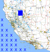
California and Nevada: 121°W/40°N to 120°W/39°N
 |
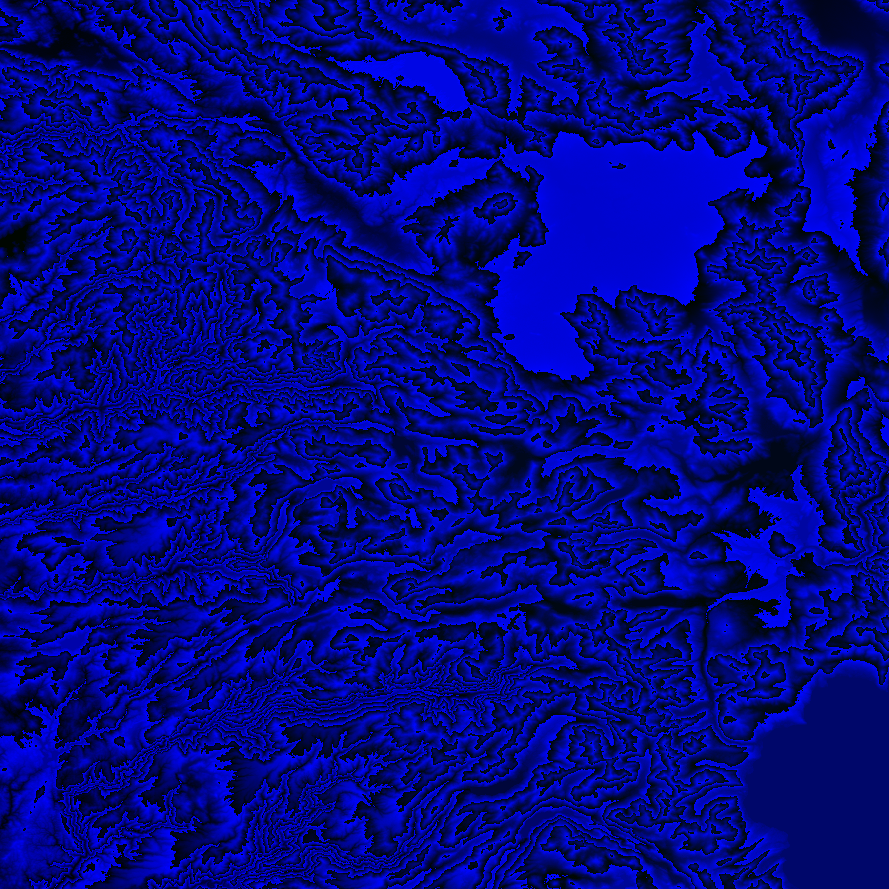
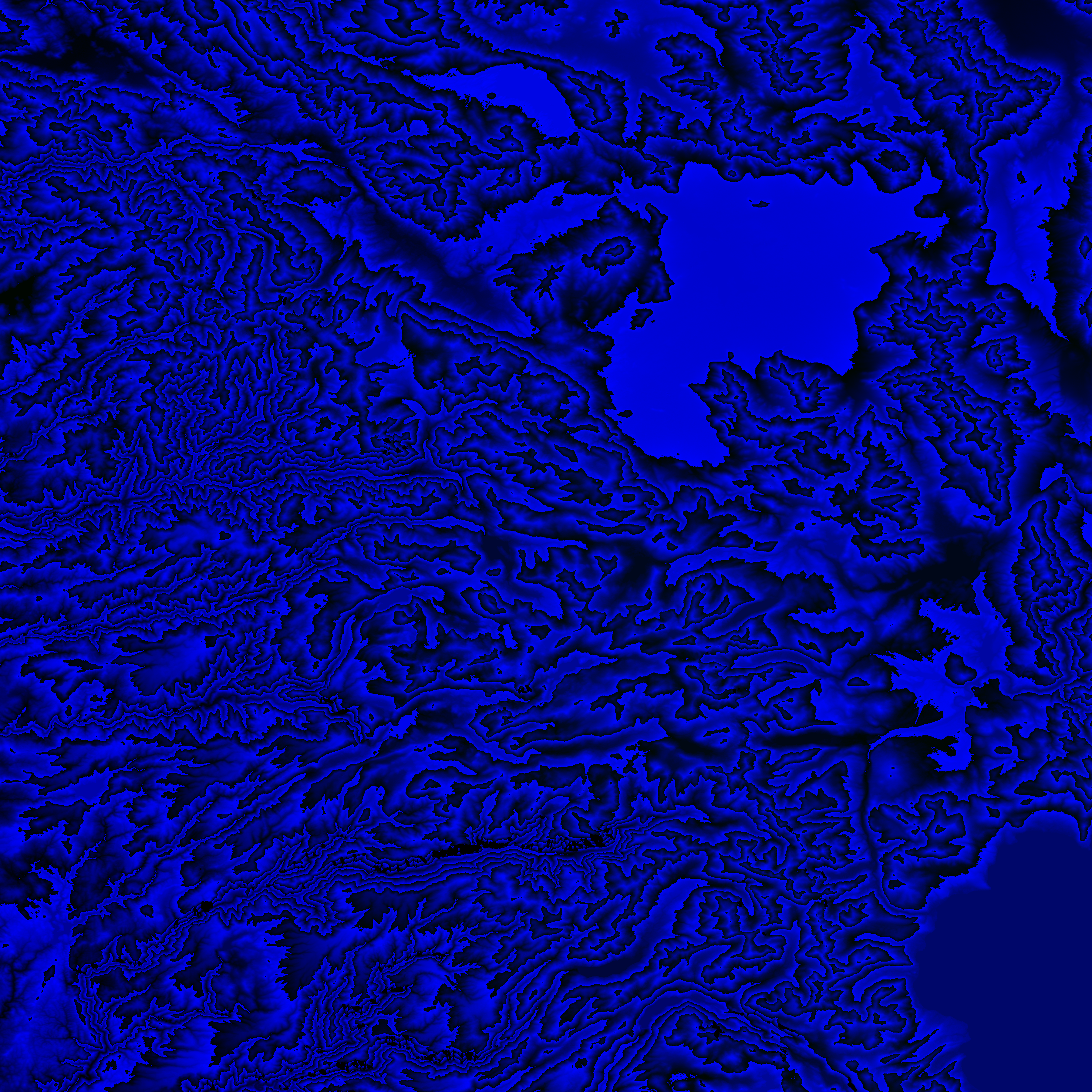
Shuttle Radar Topography Mission |
 |
U. S. Census Bureau Tiger Map Server |
Elevation File
40N121W_el.tga.bz2 (6629926 bytes)
40N121W_el.png (8445800 bytes)
40N121W_el-uncorrected.tga.bz2 (6612929 bytes)
40N121W_el-uncorrected.png (8444047 bytes)
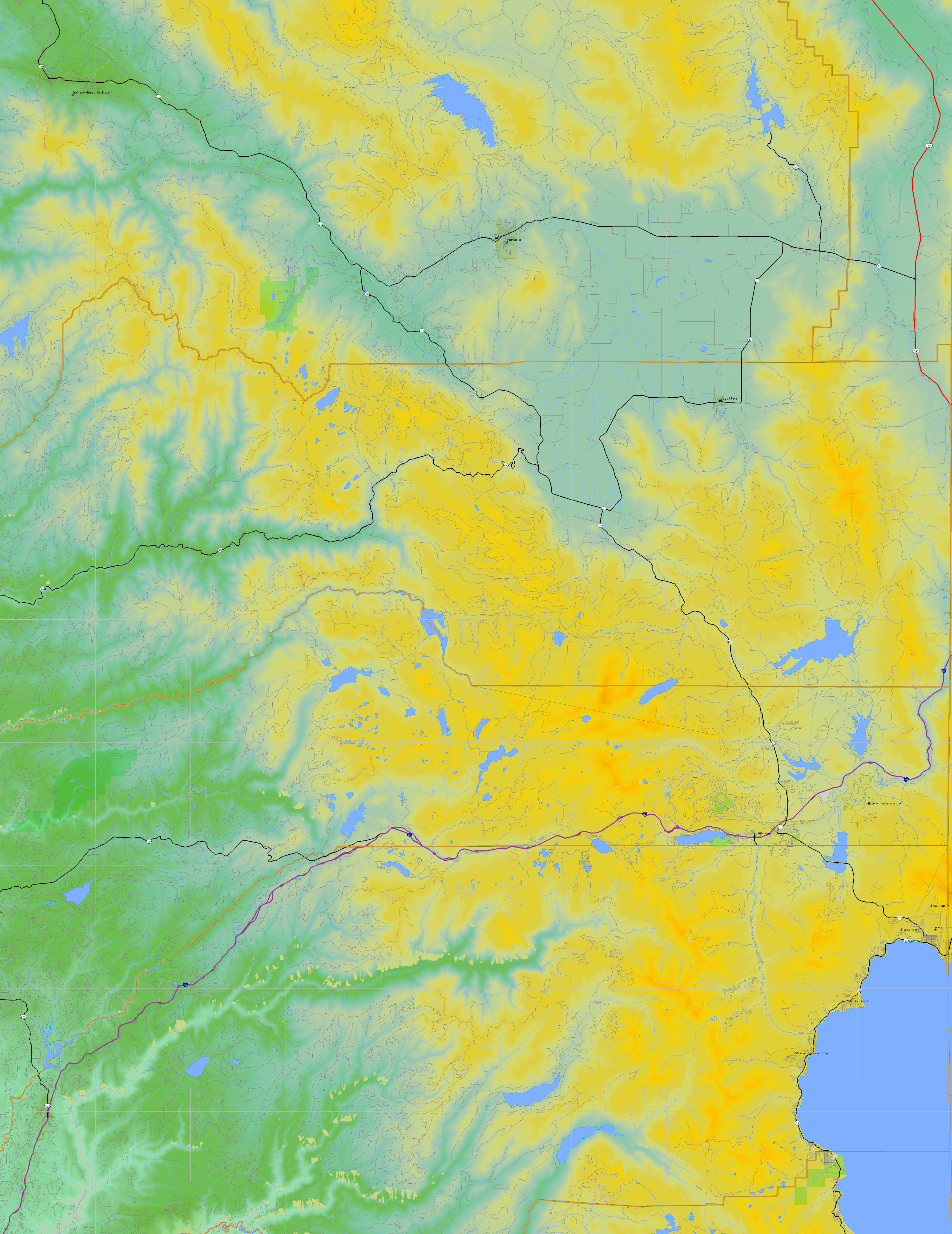
Texture File
40N121W_tx_c.tga.bz2 (10800291 bytes)
40N121W_tx_c.png (15473090 bytes)
 |
 |
 |
 |
 |
 |
 |
 |
 |