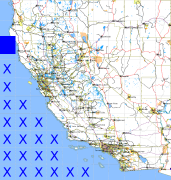
California and Nevada: 125°W/40°N to 124°W/39°N
 |
Shuttle Radar Topography Mission |
 |
U. S. Census Bureau Tiger Map Server |
Elevation File
40N125W_el.tga.bz2 (3463 bytes)
40N125W_el.png (50337 bytes)
40N125W_el-uncorrected.tga.bz2 (3442 bytes)
40N125W_el-uncorrected.png (54077 bytes)
Texture File
40N125W_tx_c.tga.bz2 (25957 bytes)
40N125W_tx_c.png (215907 bytes)
 |
 |
 |
 |
 |
 |
 |
 |
 |