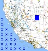
California and Nevada: 117°W/39°N to 116°W/38°N
 |
Shuttle Radar Topography Mission |
 |
U. S. Census Bureau Tiger Map Server |
Elevation File
39N117W_el.tga.bz2 (5471156 bytes)
39N117W_el.png (7134546 bytes)
39N117W_el-uncorrected.tga.bz2 (5467433 bytes)
39N117W_el-uncorrected.png (7134687 bytes)
Texture File
39N117W_tx_c.tga.bz2 (5058319 bytes)
39N117W_tx_c.png (8008568 bytes)
 |
 |
 |
 |
 |
 |
 |
 |
 |