TruFlite for Windows Workshop - www.truflite.com
[Home] | [Workshop] | [30" Data, Overview] | [Data Import, 30" Data] | [Scene 1] | [Scene 2] | [Scene 3] | [Scene 4] | [Colorize] | [Scene 5] | [Scene 6]
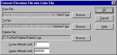
Menu: "Calculate/Format Conversions/Elevation To Color...":
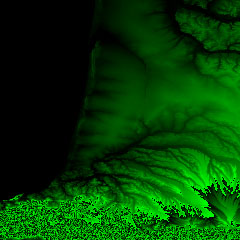
| elevation file "dem1.tga" | output file "texture1.tga" |
|---|---|
 |
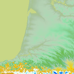 |
| palette file "palette1.tga" | |
Why the "Upper Altitude Limit" of 400000?
Our elevation values are multiples of 256. The highest mountains in our area are probably 3000 meters high. To make use of the palette file's full extent we would need to specify 256*3000=768000 as the upper limit. However, as we know, the major part of the terrain is rather shallow. So we decide to use the palette on elevations between 0 and 400000 units (=400000/256 = 1562.5 meters) only. Thus any terrain above 1560 meters will show in a uniform dark blue color.
Save the result as "scene5.trf" - our next step.
This page was last updated:
11/10/23.
Copyright © 1996-2023 Martin D. Adamiker's. All Rights Reserved.