

What's New With TruFlite?
![]()
TruFlite V 6.0 beta demo version plus woska V 1.0 (08/30/2009)
woska is our new geocoder and download helper: this here version is fully functional! Get it today to download OpenStreetMap street maps from all over the world and combine them with SRTM elevation data! woska corrects NODATA areas by interpolation! That is, no gaping holes appear in the 3D image where SRTM data are missing.
TruFlite V 6.0 uses a revolutionary approach for setting the flight path: you can point the camera any direction, even focus it on a point of interest so that it will not escape the frame.
![]()
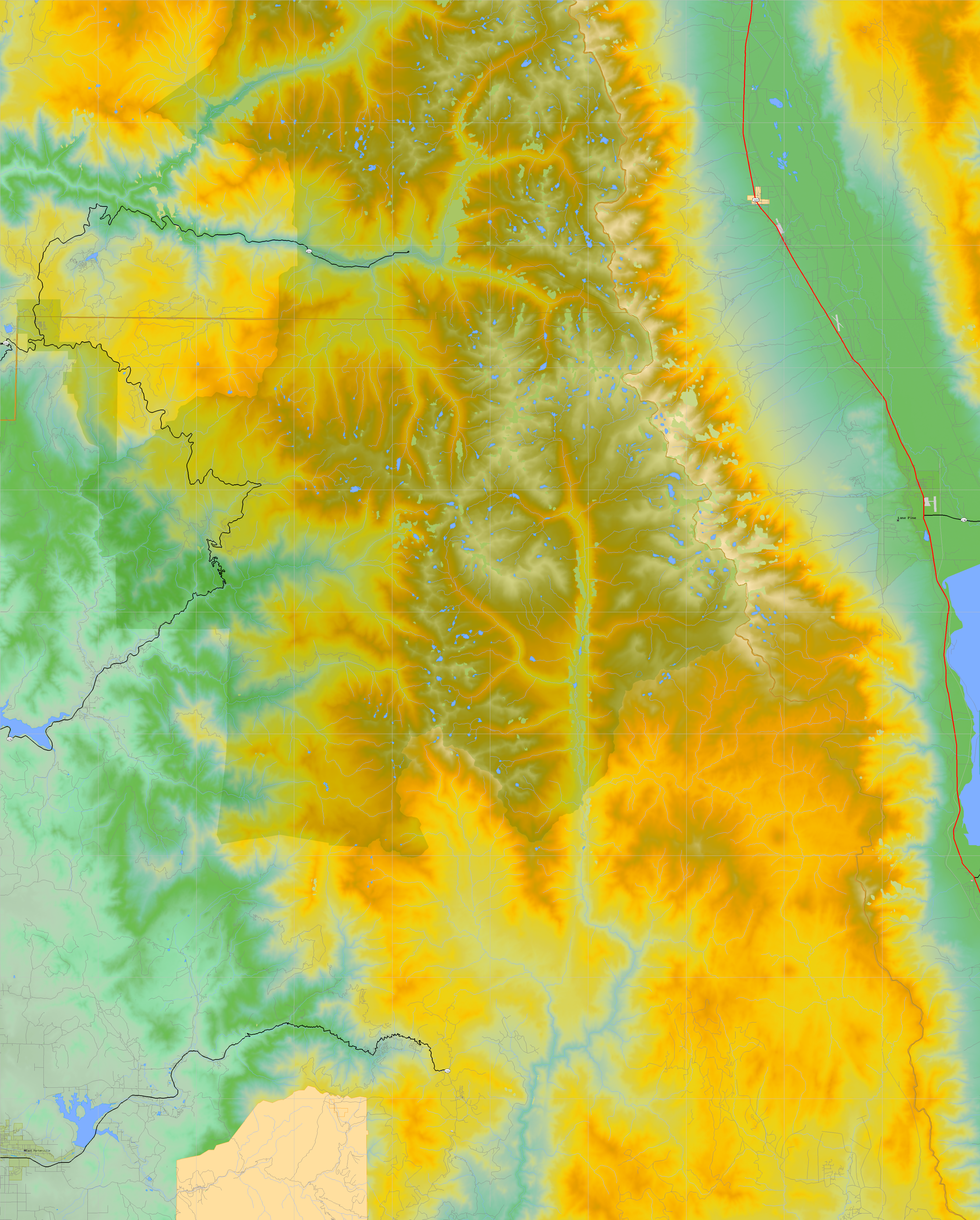
California and Nevada, high quality (05/30/2009)
These two states are the first where at Martin D. Adamiker's:
- SRTM (Shuttle Radar Topography Mission) data were post-processed to interpolate void areas;
- U.S. Census Bureau Tiger map data were converted to colored texture files;
- a clickable image map was created to navigate through the states;
- one by one degree quads are now available as TGA files, ready to be
used with TruFlite. PNG files also available. The file sizes are between
0.1 and 16 MB, depending on the terrain. Even if you never used
TruFlite, have a look , you'll be excited, they're simply beautiful!
Example: 37N119W_tx_c.png (13473907 bytes)
![]()
Map of the United States (01/15/2009)
A clickable map using U.S. Census Bureau Tiger map files, down to one by one dgree quads.
![]()
geoDataClient is out! (09/20/2008)
A free gazetteer tool lets you to convert U.S. addresses into TruFlite images.
Just type the address, have it geocoded, and get the USGS and Bureau of the Census data!
All you need to know is the mailing address of the place!
![]()
High quality images from SRTM data (03/25/2007)
Two high resolution images using U.S. Bureau of the Census and USGS SRTM (Shuttle Rarad Topography Mission) data: Minneapolis and New Jersey/New York. Even though the quality is amazing, it did not take longer than 6 minutes to produce each of these two images, from the decision which city to render to the final result.
![]()
Joshua Tree National Park flyover (01/21/2007)
A 55 MB NTSC compliant (MPEG2 Video 720x480 30.00fps) video.
![]()
TruFlite 5.11 is out (09/26/2006)
The latest version has added context sensitive help features, more multi-threaded conversion tasks and an ESRI ASCII grid import filter.
![]()
California MPEG (02/06/2006)
As an example, this MPEG animation of a flight over Southern California demonstrates TruFlite's incredible capabilities.
![]()
Panoramas (02/05/2006)
The Java based open and free panorama viewer PTViewer (c) Helmut Dersch is used to display 360 degree panoramas of three places in California.
To view panoramas, click here.
![]()
Using finished SRTM data (05/22/2004)
In accordance with NASA policy, the USGS EROS Data Center hosts and distributes SRTM data via the USGS Seamless Data Distribution System - Enhanced. http://srtm.usgs.gov
After reviewing and updating level II data, finished data sets are now available on DVD from the EROS Data Center. These data sets cover the United States area at one arc second resolution.
We will publish images made from the updated data this summer. Meanwhile, see our Gallery page for level II samples.
![]()
TFMAKE V5.0 is out (03/02/2004)
TFMAKE makes 3D terrain visualization child's play.
![]()
U. S. representative (07/23/2003)
Brenton White joined us as an authorized TruFlite distributor and technical support center.
http://www.brentonwhite.com/truflite/index.htm
![]()
SRTM samples available (03/14/2003)
In accordance with NASA policy, the USGS EROS Data Center hosts and distributes SRTM data via the USGS Seamless Data Distribution System - Enhanced. http://srtm.usgs.gov
See our Gallery page for samples.
![]()