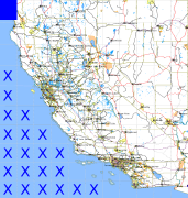
California and Nevada: 125°W/42°N to 124°W/41°N
 |
Shuttle Radar Topography Mission |
 |
U. S. Census Bureau Tiger Map Server |
Elevation File
42N125W_el.tga.bz2 (873005 bytes)
42N125W_el.png (1428241 bytes)
42N125W_el-uncorrected.tga.bz2 (871575 bytes)
42N125W_el-uncorrected.png (1425414 bytes)
Texture File
42N125W_tx_c.tga.bz2 (1699207 bytes)
42N125W_tx_c.png (2739296 bytes)
 |
 |
 |
 |
 |
 |
 |
 |
 |