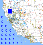
California and Nevada: 123°W/40°N to 122°W/39°N
 |
Shuttle Radar Topography Mission |
 |
U. S. Census Bureau Tiger Map Server |
Elevation File
40N123W_el.tga.bz2 (5635515 bytes)
40N123W_el.png (7312929 bytes)
40N123W_el-uncorrected.tga.bz2 (5635559 bytes)
40N123W_el-uncorrected.png (7313100 bytes)
Texture File
40N123W_tx_c.tga.bz2 (7777288 bytes)
40N123W_tx_c.png (11638160 bytes)
 |
 |
 |
 |
 |
 |
 |
 |
 |