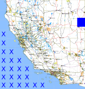
California and Nevada: 115°W/40°N to 114°W/39°N
 |
Shuttle Radar Topography Mission |
 |
U. S. Census Bureau Tiger Map Server |
Elevation File
40N115W_el.tga.bz2 (5995300 bytes)
40N115W_el.png (7761175 bytes)
40N115W_el-uncorrected.tga.bz2 (5990702 bytes)
40N115W_el-uncorrected.png (7756484 bytes)
Texture File
40N115W_tx_c.tga.bz2 (6360260 bytes)
40N115W_tx_c.png (9768355 bytes)
 |
 |
 |
 |
 |
 |
 |
 |
 |