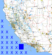
California and Nevada: 121°W/34°N to 120°W/33°N
 |
Shuttle Radar Topography Mission |
 |
U. S. Census Bureau Tiger Map Server |
Elevation File
34N121W_el.tga.bz2 (121090 bytes)
34N121W_el.png (226972 bytes)
34N121W_el-uncorrected.tga.bz2 (121266 bytes)
34N121W_el-uncorrected.png (226975 bytes)
Texture File
34N121W_tx_c.tga.bz2 (140073 bytes)
34N121W_tx_c.png (401357 bytes)
 |
 |
 |
 |
 |
 |
 |
 |
 |