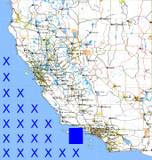
California and Nevada: 120°W/34°N to 119°W/33°N
 |
Shuttle Radar Topography Mission |
 |
U. S. Census Bureau Tiger Map Server |
Elevation File
34N120W_el.tga.bz2 (107412 bytes)
34N120W_el.png (212301 bytes)
34N120W_el-uncorrected.tga.bz2 (107303 bytes)
34N120W_el-uncorrected.png (212295 bytes)
Texture File
34N120W_tx_c.tga.bz2 (125094 bytes)
34N120W_tx_c.png (374337 bytes)
 |
 |
 |
 |
 |
 |
 |
 |
 |