

Example
MPEG Animation of a Flight over Southern California
The source data cover an area between 123W35N (SW corner) and 120W38N (NE corner).
The elevation file is 10803 by 10803 pixels.
This example uses the following data:
- Elevation data: Shuttle Radar Topography Mission (SRTM) elevation data, 1 arc second resolution;
- Texture data: U.S. Bureau of the Census, resolution approx. 30 meters.
|
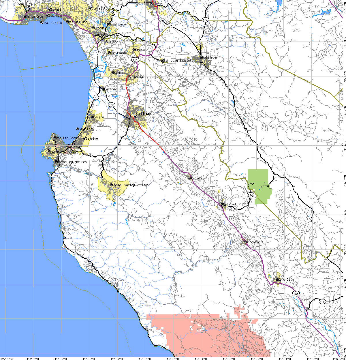
This is one of the original U.S. Bureau of the Census
quads used as the texture. The whole texture consists of 3 x 3 such
quads.
The URL for this quad is: http://tiger.census.gov/cgi-bin/mapper/map.gif?... The texture used in the MPEG animations is a blend of:
|
||
| 320x240 | 640x480 | ||
| CA_MPEG-320x240-1.mpg (6.3 MB) | CA_MPEG-640x480-1.mpg (27.3 MB) | 45 second animation. Each of the 1150 frames is rendered at a resolution of 2048 by 2048 squares. | |
| CA_MPEG-320x240-2.mpg (7.7 MB) | CA_MPEG-640x480-2.mpg (33.2 MB) | 55 second animation. Each of the 1375 frames is rendered at a resolution of 8192 by 8192 squares, a total of close to 200 billion polygons. | |